ƒ  a  r  ƒ  e  t  c  h  i  n  g
mystery | meaning | movement
  • home
    • Why Farfetching?
  • musings (blog)
  • movies
    • A Beautiful Mind
    • The Hunger Games
    • Tron: Legacy
  • music
    • Foals >
      • Bad Habit
    • Mumford & Sons >
      • Babel >
        • "Below My Feet"
      • Sigh No More
    • Nickel Creek >
      • Doubting Thomas
  • media
    • A Game of Thrones (A Song of Ice and Fire)
  • minister
    • Classes
    • PIF
    • Sermons >
      • Written Sermons
      • Audio Sermons
      • Video Sermons
    • Weddings
  • me
    • Where Am I?
    • Ender's Gospel
  • Book: Tahoe
    • Chapter One: We All Live in a Yellow School Bus
    • Chapter Two: Strawberry Fields Forever
    • Chapter Three: Nash-Vegas
    • Appendix: Eulogy
  • The Lost Art of Romance
  • Faith, Inc.
  • Evans in Seminary
  • Evans in Africa

Hiking Sleeping Giant / Nounou Mountain

1/24/2014

1 Comment

 
Picture
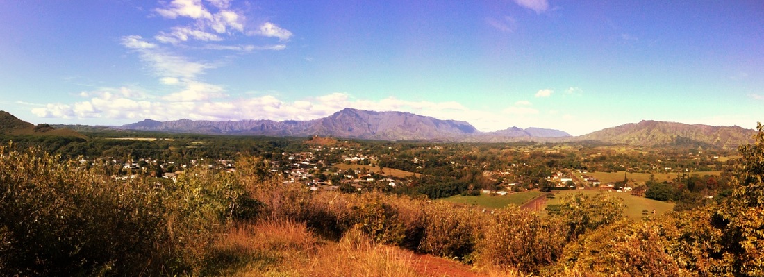
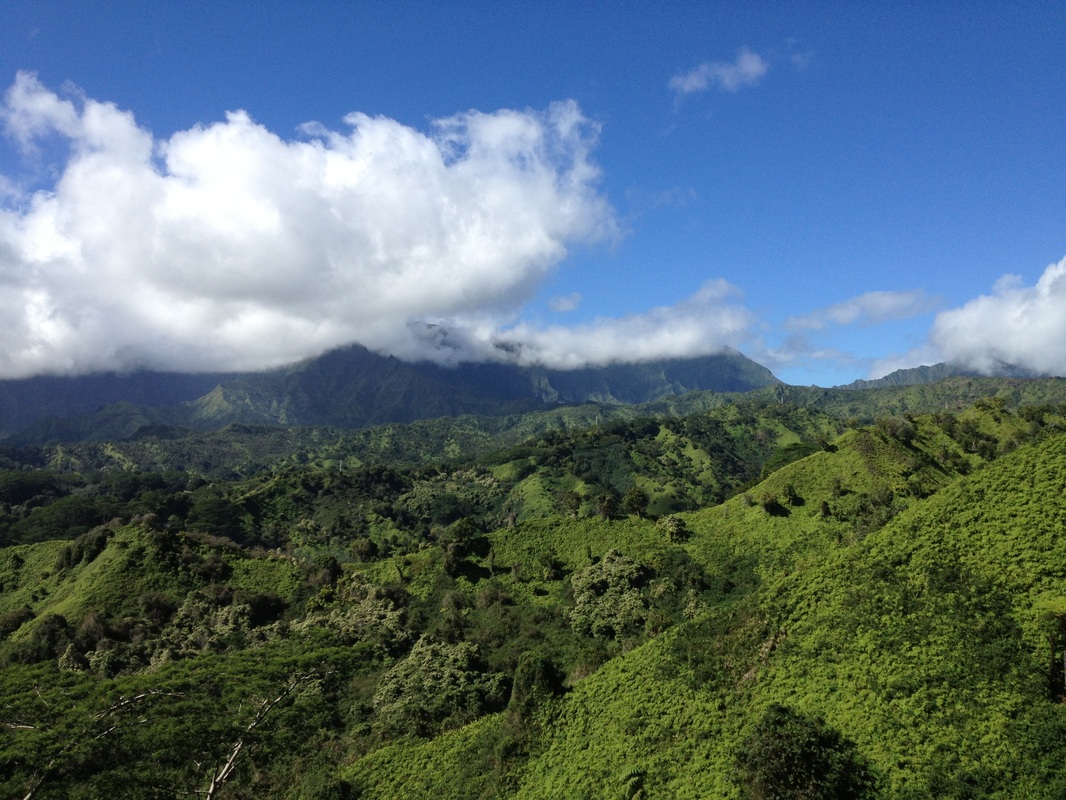
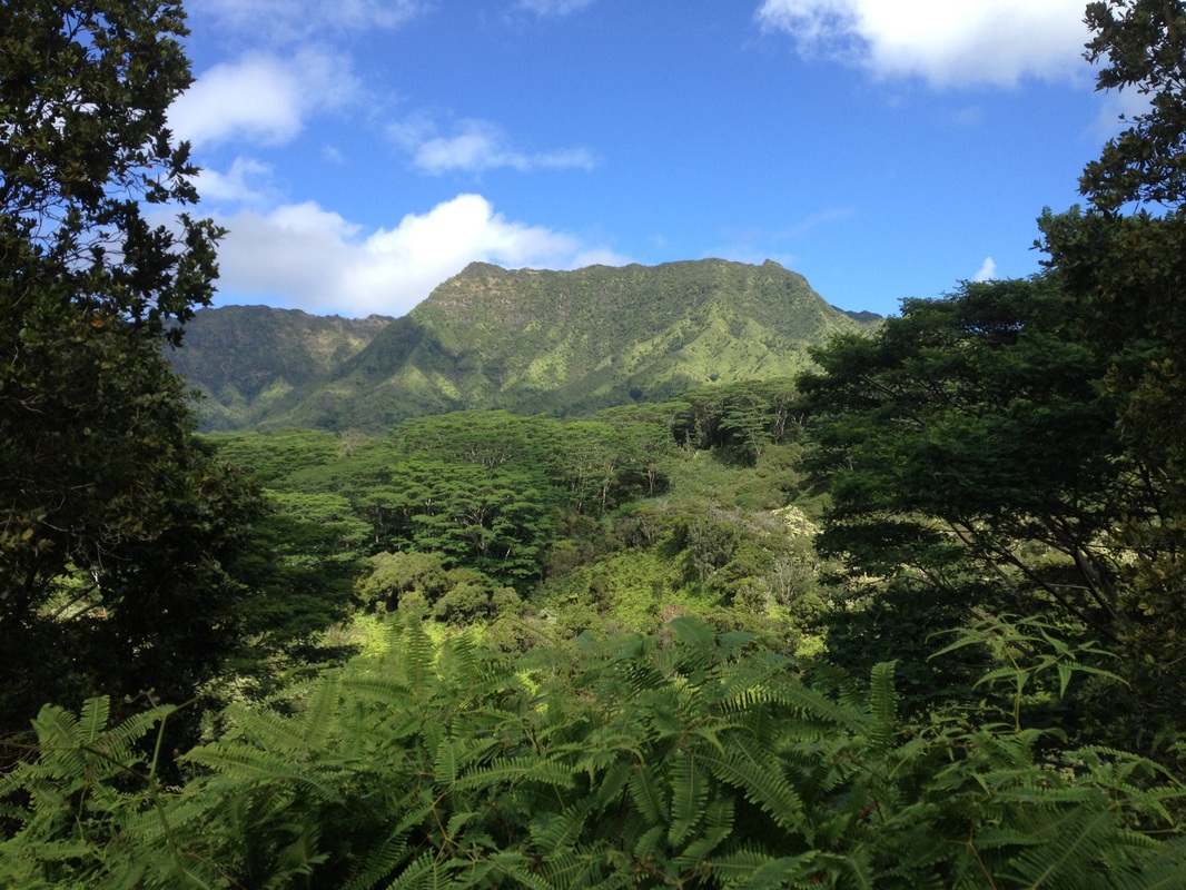
Mount Wai'ale'ale on a clear day with Wailua Homesteads in the foreground.
Had a grand hike up Sleeping Giant (Nounou) Mountain with incredible views of the East shore.  
Picture
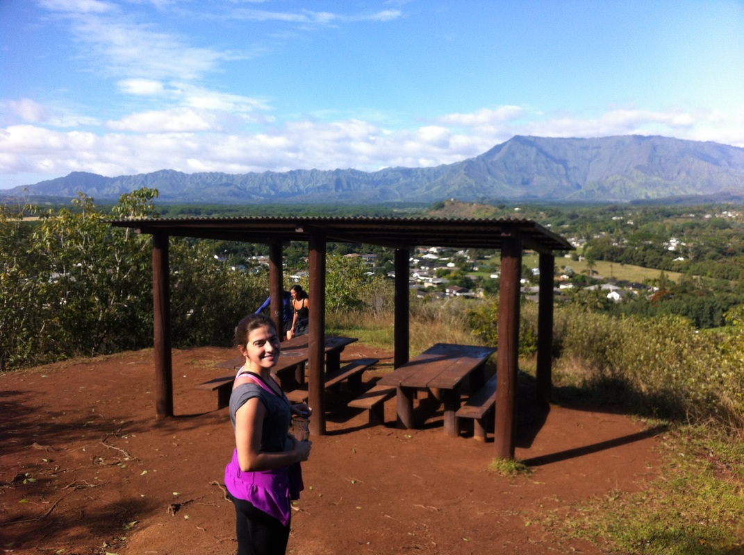
First stop from the South Side trail.
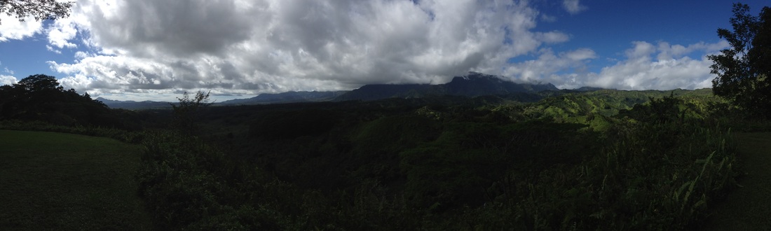
Another view of Wai'ale'ale and the Wailua Homesteads, further on the trail.
Picture
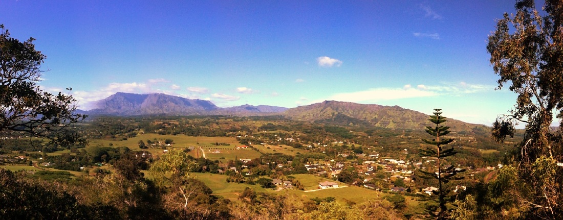
After about two miles we made it to the top.
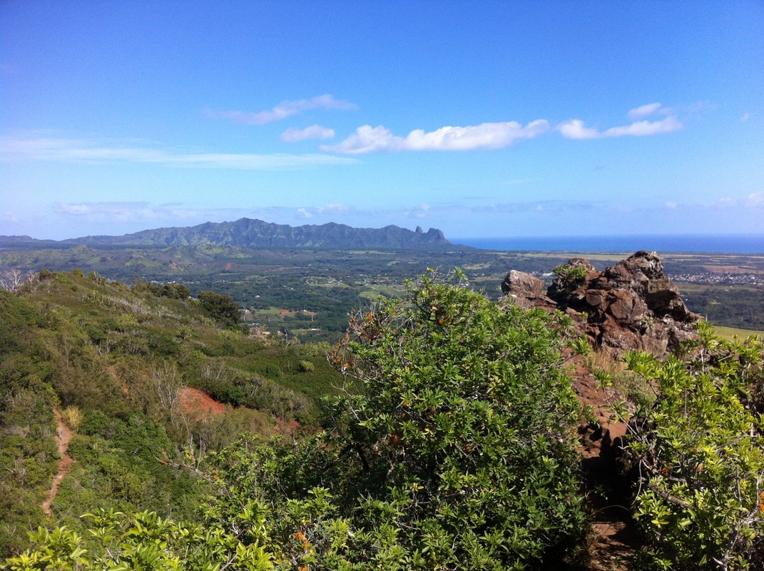
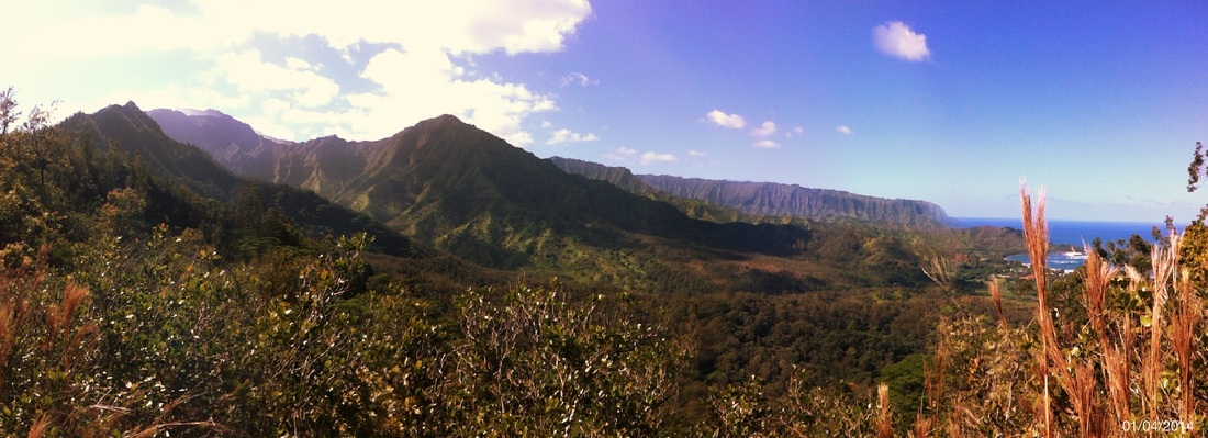
Picture
Anahola Mountain
(you can see the trail in the lower left-hand corner)
With some spectacular views of the East Shore!
Picture
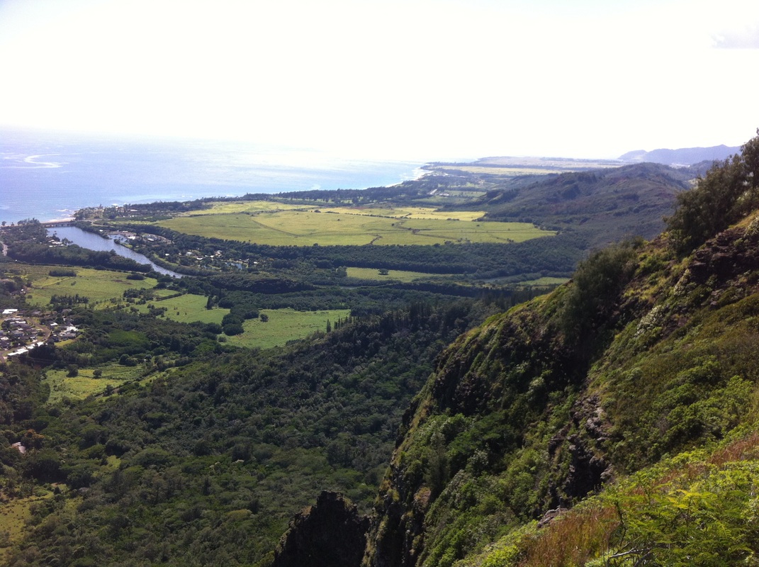
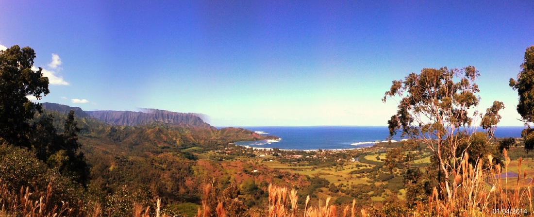
Wailua River meets the Pacific Ocean
We had to share the picnic area near the top with this dude.  These "king toads" are quite big and plentiful but harmless.
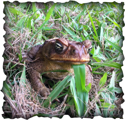
Picture
Mr. King Toad
1 Comment

Hiking the Moalepe/Kuilau Trail

1/19/2014

0 Comments

 
Picture
Emily with Koa and Uila at Picnic Area along Kuilau Trail
Emily and I decided to take the dogs, Uila (WEE-la) and Koa (KO-a), up the Moalepe Trail up near us between the Wailua Homesteads and Kapahi.  After passing by some pastures on a gradual ascent along a washed out dirt road, we got up into the foothills for some incredible views of Sleeping Giant, bits of the ocean and Kaua'i's central mountain, Waiale'ale (which was covered in clouds, as usual).  
Picture
Lookout just beyond the end of Moalepe Trail
The trail is 2.5 miles and you may catch the quarter-mile markers beginning around 2 if you keep an eye out.  There is a sign marking the end of the trail at a bridge with a cool grotto area.  I strongly recommend continuing on the Kuilau Trail up around the grotto area to a breath-taking lookout about 100 yards beyond the sign.  
Picture
A successful hike with typically cloud-covered mountains(!)
A half mile further (so 3 miles out) is a picnic area with a near-360 view, open grassy area big enough for a football game or frisbee, and simple picnic pavilion.  If you stay on the trail you will end up at the Keahua Arboretum, another possible starting point that is not as far (you would be taking the Kuilau Trail to the picnic area).
Picture
View of mountain backdrop along Moalepe/Kuilau Trail
Getting There: This is an East Side hike up behind Kapa'a.  Take Olohena Road all the way until it ends with Waipouli Road.  You will see the dirt road clearly marked beyond the metal the gate. 
Picture
Panorama of cloud-covered Waiale'ale
What to Bring: Bring at least a quart of water, especially on a hot day.  Sun protection is recommended as lots of the hike in the beginning is exposed.  The trail is rated as moderate with gradual gains and descent; very few steep sections.  A few muddy spots but overall not bad at all (for Kaua'i!).  Trail can be slippery at points but most of the time it is wide enough for a vehicle.  We saw cyclists and horseback riders in addition to hikers - dogs did fine and great one for them!
Picnic Panorama with Em
Panorama at Picnic Area along Kuilau Trail
0 Comments

Hiking the Okolehao Trail

1/4/2014

1 Comment

 
Picture
This was my first real hike in Kaua'i, and I couldn't ask for more spectacular weather and views!  I must have seen at least ten helicopter tours, and I can guarantee I was paying a lot less to see some gorgeous scenery.
Picture
Getting There: You will find the trail about a mile from the  main Hanalei Bridge.  From Princeville, take a left immediately after crossing the main bridge.  From Hanalei, it is the last right just before crossing the bridge to go up to Princeville.  Drive about one mile, and you will see a dirt parking lot on your left.  Across the road to the right is the trail head.  

View Larger Map
Picture
Trail Itself: The first mile can be quite muddy, but push on for some great views.  There are some ground netting early on that helps with mud and slippery slopes.  About a mile up and there is the first lookout at a power line tower.  Another mile up (the mud has decreased, but you still need to watch your footing) and there is an even better near 360-degree view of the Hanalei Bay and surrounding valley.  You could easily stop here, having climbed 1,250 feet, but I went on a very narrow trail that followed the ridge line up and down slippery slopes with ropes until I reached the tallest point marked by a tall evergreen (about 4 miles up, 8 miles round trip I estimate). There were about two more peaks I could see beyond where I went (see below), but I was satisfied (and out of water!). 
Picture
What to Bring: At least 2 quarts water to make it to the top, sunscreen, hat/sunglasses, good shoes that can handle mud, hiking stick or other gear for steep ascents, gloves to protect your hands on the ropes if you go beyond the initial two miles, lightweight long pants to protect from brush. Most of the time you are going in and out of shade.  
Picture
My legs burned several days after this hike; perhaps a day recovery if you only did the initial two miles (what's on the map).  I would only take dogs on the first mile or so, when the trail is wider, but if you're going in the rainy months (late Nov - early Mar) be prepared for plenty of mud early on.
1 Comment
Forward>>

    Author

    Evans McGowan

    Archives

    July 2014
    May 2014
    April 2014
    March 2014
    February 2014
    January 2014
    September 2013
    August 2013
    April 2013
    March 2013

    Categories

    All
    Adventure
    Africa
    Beach
    Bible Reference
    Biking
    Books
    Canada
    Community
    Economics
    Faith
    Hiking
    History
    Kauai
    Kayaking
    Media
    Medicinetribe
    Mftp
    Movies
    Nature
    Peace
    Poem
    Politics
    Purpose
    Qigong
    Quotes
    Religious
    River
    Science
    Self Help
    Self-help
    Social Commentary
    Social Commentary
    Social Justice
    Sports
    Tai Chi
    Technology
    War
    Wisconsin

    RSS Feed

Quick Links

Blog
Profile
Resume
Current Project
Contact