ƒ  a  r  ƒ  e  t  c  h  i  n  g
mystery | meaning | movement
  • home
    • Why Farfetching?
  • musings (blog)
  • movies
    • A Beautiful Mind
    • The Hunger Games
    • Tron: Legacy
  • music
    • Foals >
      • Bad Habit
    • Mumford & Sons >
      • Babel >
        • "Below My Feet"
      • Sigh No More
    • Nickel Creek >
      • Doubting Thomas
  • media
    • A Game of Thrones (A Song of Ice and Fire)
  • minister
    • Classes
    • PIF
    • Sermons >
      • Written Sermons
      • Audio Sermons
      • Video Sermons
    • Weddings
  • me
    • Where Am I?
    • Ender's Gospel
  • Book: Tahoe
    • Chapter One: We All Live in a Yellow School Bus
    • Chapter Two: Strawberry Fields Forever
    • Chapter Three: Nash-Vegas
    • Appendix: Eulogy
  • The Lost Art of Romance
  • Faith, Inc.
  • Evans in Seminary
  • Evans in Africa

Hikina-a-ka-la at Lydgate Beach Park

3/25/2014

0 Comments

 
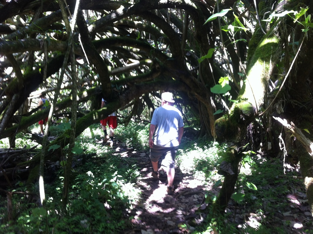
An article I wrote for a forthcoming driving-CD of the island of Kaua'i.  Visit www.kauaidrivetours.com for more information.
Picture
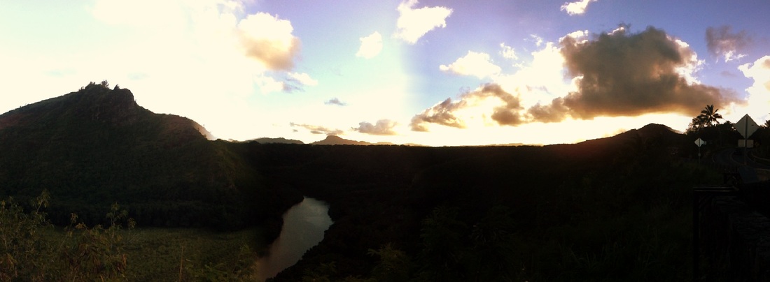
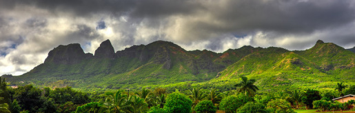
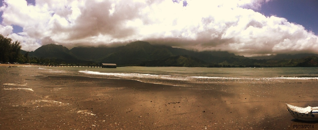
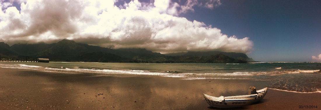
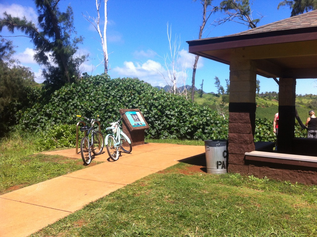
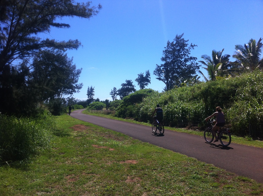
Approaching Wailua from the south, you will see Lydgate Beach Park on your right just before you cross over the Wailua River.  This place of sea and sand marks the sacred gateway into the heart of the island.  Called hauola or “dew of life,” this area around the river’s mouth was well renown as a place of healing and wholeness.  Here many ancient Tahitian voyages would embark and arrive, and many ali’i or chiefs resided.  Remnants of large volcanic boulders just off shore create a small, somewhat protected area for swimming and snorkeling.  The last king of Kaua‘i, King Kaumualii, used to swim here.

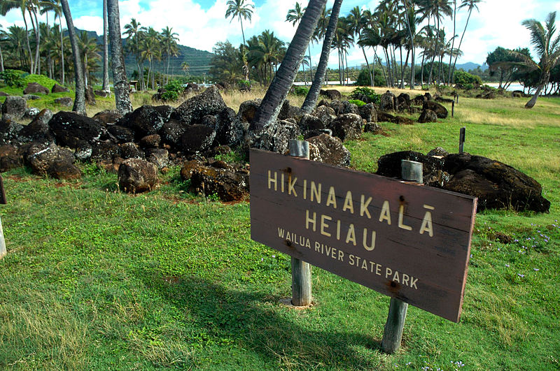
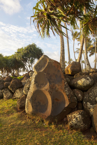
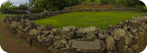
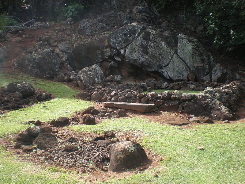
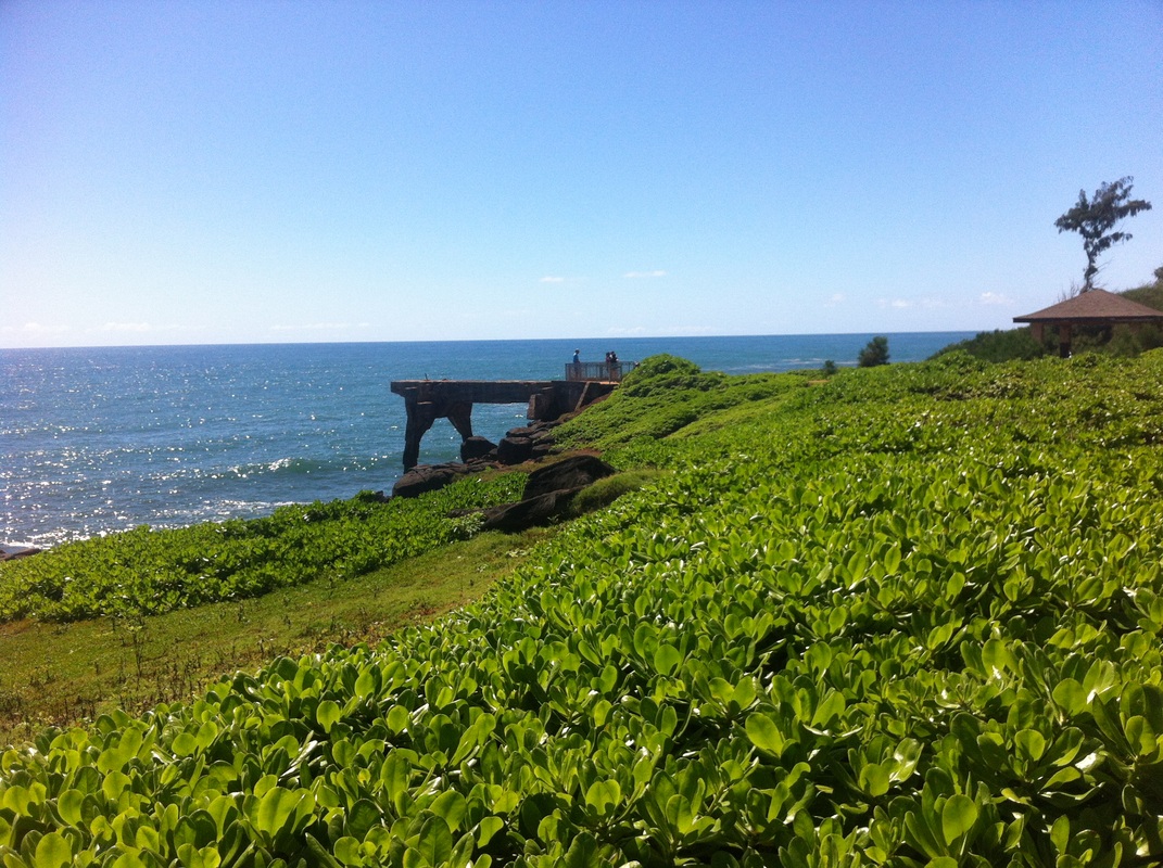
At the north end of Lydgate Beach Park next to the river’s mouth is a heiau erected in the 14th century.  The original structure, called Hikina-a-ka-la or “The Rising of the Sun,” rose like a mighty fortress, measuring 80 feet wide and nearly 400 feet long, with walls six feet high and over eight feet thick.  Each day at dawn, the sun’s first rays broke through the sea’s salt spray and warmed the stacked stones.  Kahuna or priests would greet the rising sun with chants and prayers.  They placed wooden statues or ki’i along the river wall to keep watch and sway with the shifting tides. 
Picture
Within the heiau walls was a pu’uhonua, a place of refuge for those fleeing a crime.  After a few days of performing sacred rights, a refugee would be released without being punished.  Various people sought refuge here during times of war.  

Today, all that remains are foundation stones amidst a grove of coconut trees.  Remember that this heiau is still a sacred place.  People often leave offerings wrapped in ti leaves.  May these offerings and this sacred place continue to offer healing for all. 
0 Comments

HOLOHOLOKU HEIAU 

3/22/2014

0 Comments

 
An article I wrote for a forthcoming driving tour on CD for Kaua'i.  Visit www.kauaidrivetours.com for more information.
Picture
Turning onto Kuamo‘o Road (Highway 580), you are now entering Wailua Nui Honoa, the Great Sacred Wailua river basin, one of the two most sacred sites in all of the Hawaiian Islands.  Less than a quarter mile on your left is a small turnout at the Holoholoku Heiau, the oldest place of worship on Kauai.  Here the Hawaiians honored the beginning and end of life. 

The low stone wall you see, measuring 24 by 40 feet, marks the original foundation of the heiau.  This heiau honored all of the Hawaiian gods, giving particular recognition to Ku.  Ku literally means “rising upright,” as in the rising sun over the ocean nearby, and often the Hawaiians worshipped Ku for good fortune and prosperity in their endeavors.  Archeologists believe animal or possibly human sacrifices were part of the worship here.
Picture
Just as life ends, so does it begin.  Walk a few meters beyond the heiau to a small cliff face and another sacred site called the Birthstone, where the last king of Kaua‘i, King Kaumualii, was born.  The flat sandstone in front of the small stone foundation marks the remains of a sacrificed dog, making the area kapu or forbidden to commoners.  
Picture
Inside the stone wall was a hut for the expectant mother.  When the time came, she leaned on the birthstone, Pohaku Hoohanau, to your left, and placed her feet on the umbilical stone, Pohaku Piko.  The umbilical cord, representing past connection, was wrapped in kapa leaves and wedged in the large crack in the cliff to protect it from rats.  A rat eating the cord meant the child would become a thief.  No matter one’s lineage, a future chief had to be born on this stone in order to be chief and absorb the sacred mana or energy of this place.  Here, place matters.

The modern staircase leads to a Japanese cemetery dating from the 1890s.  Return to your car to continue up Kuamo‘o Road, built on an ancient path called “The Way of the Kings.”  Many chiefs would travel along the Kuamo‘o or “Spine of the Lizard” on their annual pilgrimage, stopping at one of seven sacred sites, including Holoholoku, until they reached Mount Waialeale.
0 Comments

A Little Kapahi "Backcountry" Adventure

3/20/2014

0 Comments

 
Picture
Turtling with Kalalea Mountain in the background... my head overlaps the head of the "sleeping goddess"
I had an interview today at Kapaa High School in order to get a letter of approval in order to take a class in May in order to be a substitute teacher!  Whew!  I'm not sure what possessed me, but while walking back my explorer's itch started acting up, and I decided to explore some of the side roads in Kapahi, the neighborhood in north Kapaa where we live.
Picture
The side roads end in spectacular vistas of Anahola to the north with the impressive formations of the Kalalea Mountains.
Picture
Someone's converted house... me in another lifetime??
At the bottom of the road, I came across an "encampment" consisting of a house built in conjunction with a school bus, linked to some solar panels.  Quite the setup!
Picture
Not far away and I saw a tent at the edge of a meadow.  Whether or not these people own the land, the owner permits their presence or they're just squatting, I'm not sure, but I'm sure someone knows what's going on... just not me!
Picture
A million-dollar view of million-dollar homes
I eventually made it up to the other side of the valley to get a nice view of all the really nice homes lining the opposite ridge.
Picture
Remnants of a folding chair
There is a lot of trash on this island.  I'm not sure if it's an island thing where it's just hard to dispose of trash - it certainly costs money - or what, but you can find evidence of human waste pretty much anywhere (sadly).
Picture
Our community house to the left, Kalalea Mountain to the right - not bad!
Eventually I made it through some trees and brush to find a meandering road that got me back to the main road.  I passed by a mansion on top of the hill and another "encampment" down in the valley.  A tale of two camps, if you will.

I took care not to blatantly trespass or disturb anyone, but I was probably on private land from time to time.  All in all, it was a fun trek through the 'backcountry' of Kapahi, and as I returned through our neighborhood, I said to myself, "I could see myself making a life here."

We will see what happens!
0 Comments

Horses in Our Backyard(!)

3/19/2014

0 Comments

 
Emily and I are currently living in a eesty-tweetsy cabin, merely 10x10 or 100 sq. ft. plus a lofted area where we sleep.  But the benefits are cool ocean breezes blowing through the tropical trees all around us, and... horses in a pasture right next door!
Picture
Through our "bedroom" / loft window
Picture
Emily gives this one some chi - they've been more friendly since she said hello to them and gave them energy work
Picture
Prime candidate for unicorn, in my opinion
Picture
This one almost looks like a pony
Picture
Maila, a kid from one of the families, feeds the horses
Picture
Palm fronds seem to be their favorite
0 Comments

Rainbows!  Double Rainbows!

3/18/2014

0 Comments

 
Did I mention this was the place of rainbows?
Picture
Double Rainbow over Soccer Field at Lydgate Park
Picture
Full rainbow arcing over Soccer Field at Lydgate Park
0 Comments

Kalalea (King Kong) Mountain

3/17/2014

1 Comment

 
A brief article I submitted today for a project creating an audio-CD driving tour of the island.  Visit www.kauaidrivetours.com for more information.
Picture
The Kalalea Mountain Range
Let your gaze wander to the mauka or mountain side of the road and you cannot miss the Kalalea mountain range.  Aptly named in Hawaiian for their prominence, the mountains tower over the road as they march toward the ocean.  The small town of Anahola nestles in the ahupua’a, the traditional land division between the mountains and the sea.  Designated primarily for Hawaiian Homesteads, Anahola is home to the largest concentration of Native Hawaiians on Kaua’i.

The protruding peak closest to the ocean is Hoku’alele, meaning “shooting star.”  The Hawaiians constructed a three-terraced high place of worship here called a heiau.  Looking at the second peak inland, what do you see?  The Hawaiians saw the dorsal fin of a shark as it parted through the land heading toward the ocean, and named the peak Mano or Shark Mountain.  More recent visitors see the profile of the giant gorilla King Kong.  The peak is quite famous, appearing in the 1976 King Kong film and the opening credits of Raiders of the Lost Ark, when the Paramount Pictures mountain (Mt. Shasta) fades into the Kalalea peak (at the 1:35 mark in clip below).  
Look closely behind the peak in the saddle of the ridgeline and you may glimpse Puuanakoua, or “Hole-in-the-Mountain.”  This ancient lava tube has been exposed, covered and re-exposed by various landslides.  Several Hawaiian legends tell of huge heroes hurling spears through the mountain, piercing its side.

Now let your eyes take in the whole range and really let your imagination run wild.  What other shapes and figures do you see?  You may see a bust of George Washington, a tortoise, a hippo, and when looking at the entire range, maybe even a goddess sleeping on her back!  Can you see them all?  You may want to find a safe spot to pull over and enjoy the powerful energy or mana of these prominent peaks.  

King Kong’s profile can best be seen between mile markers 14 and 15, and a glimpse of Hole-in-the-Mountain between mile markers 15 and 16.
1 Comment

Paddling in Hanalei

3/13/2014

0 Comments

 
Picture
Today I took the inflatable kayak out to paddle the Hanalei River.  I forgot my regular kayak paddle and had to borrow a friend's paddle for stand-up paddleboarding.  Perhaps needless to say, I recommend using the proper paddle.  I made it almost to the Hanalei Bridge before turning around and going out to a sandbar at the mouth of river where it meets the bridge.  They say it takes about 2-3 hours to paddle.  I took two hours.  I plan to return and explore further up the river on a later venture.  One of the side tubes also started to deflate, but as far as I can tell it was because I did not full tighten one of the valves and then sat on it in a peculiar way.  Thankfully I fixed the problem and remained afloat!

In any event, it was glorious.  What a place to call home!
Picture
From the river looking into the bay over the sandbar
Picture
Beached craft looking into Hanalei Bay
Picture
Hanelei Bay with the pier in the background and tip of the canoe peering out
Picture
Ad for SeaEagle?
0 Comments

Kauai Bike Path

3/11/2014

0 Comments

 
Picture
Spectacular Shoreline View looking south toward Kealia Beach
The Kauai Bike Path is a multi-year project designed to follow an ancient Hawaiian path entirely up the east coast of Kauai.  It currently connects Lydgate Park in Wailua with Donkeys Beach north of Kapaa.  The paved path ends well before Anahola but one can follow a dirt path up to the point just before Anahola Bay.  Many people say it will never be completed, yet the 7 miles currently paved make for a nice and beautiful stroll or ride.
Picture
Donkeys Beach
Named by the Hawaiians for the mules seen hauling sugarcane up in the hills from here
Picture
A nice rest area overlooking Donkeys Beach
Picture
Smooth Riding
Picture
Some sort of old fishing pier
0 Comments

Our Little Cottage That Could... Not

3/7/2014

0 Comments

 
Picture
Since mid-February, Emily and I have been living in a small 100 sq. ft. (10x10) cottage.  We sleep in the loft above.  There is no plumbing and just an extension cord coming in so we can charge our phones at night.  When we first saw it, the place was filthy, covered in gecko poop and mold, as if no one had lived there in ages.  There are no windows - just screens - meaning we're exposed to the ocean breezes as well as any rain!  We walk about 20 yards to an outdoor shower.  There is a separate indoor sink and toilet for us to share with other small cabins on the property.  We also have access to the main large community building with a large living room and kitchen and dining area.  There are four apartments, most filled with families, that connect to the main area.  

In sum, it's a lot like camping, with a bit of a community feel, although most people do their own thing and there's little-to-no sense of common purpose.
Picture
Our front entrance, living room, dining, office, bedroom... you get the picture, right?
Picture
Our shelf, storage, closet, hanging space, desk... again, you get the idea.
Picture
The ladder to the loft space
Picture
Our bed in the loft
0 Comments

Hiking Makaleha

3/3/2014

0 Comments

 
Picture
Panorama of Makaleha Ridge & Valley
I went with some friends - Jon, Sam and Paul - on an adventurous hike today on the Makaleha "trail."  Trail is in quotes because the path we attempted to follow is not maintained, crisscrossing the river several times before finally disappearing into the river, leaving the hiker to now rock hop... not that we complained!
Picture
Hiking on the Makaleha Trail... when there was one!
Picture
Bring a guide/guidebook and look for these (mostly helpful) pink ties
To get there we drove to the end of Kaiwahau Road in Kapahi, up from Kealia Beach north of Kapa'a.  We parked in a dirt lot next to the water tower and were the only car there (this isn't a popular hike due to the lack of trail maintenance/ownership).  I thought I had locked the doors...
Picture
A small dam along Kealia Stream
The trail begins as a dirt road but quickly gets confusing at an old dam.  We eventually crossed the river and then made our way through a really cool bamboo forest.  I thought a picture really wouldn't do it justice, so check out the video below the picture.
Picture
Hiking Up "Bamboo Mountain"
After hiking up into the bamboo forest, along a ridge and then back down, you come across a freakin' awesome rock, perfect for bouldering!
Picture
Makaleha in Hawaiian means "eyes that glance upward" and refers to the towering, amphitheater- like ridge that was all around us as we hiked.  Winding our way through little bits and pieces of trail around and through the river, we eventually arrived to an open area with spectacular views of two or three tributaries all coming together.
Picture
Turtling in Makaleha Valley
Per the guidebook's suggestion (I don't suggest going without one, by the way, or someone who knows the way well), we ventured up the fork furthest to the right.  The valley became a narrow, almost slot canyon, until we reached an incredible, three tiered waterfall.  Check out the pictures below! 
Picture
Sam, Jon and Evans (planking/turtling) on rock
Picture
A glimpse of 3 tiers of Makaleha Falls
Picture
Our own private waterfall, Makaleha Falls
We had fun rock-hopping our way back, only trying to pick up the trail when it became too cumbersome to rock hop!
Picture
Paul takes a rock hop
We also came across some cool remnants of when the valley was used for sugar cane production, including what looked like canals and other irrigation-like ditches.
Picture
Simply beautiful: the stream, the moss, the rocks, the trees...
As we were getting back to the car, a car drove off and other car with two young local guys was parked next to ours.  They apparently got out to pee but it seemed a little odd to me at the time.  I unlocked the car but apparently the passenger door was unlocked.  Later I discovered they had stolen my wallet, including $300 cash, my ID and some credit cards, which they used to purchase gas and some apps on the Google Play store!  Not very fun, and a poignant reminder to leave no valuables in your car!  It also didn't help that we were the only car in a remote lot on a very lightly used trail.

You live, you learn, and you try to earn a living.
Picture
Ancient (100 years?) irrigation canal from sugar cane days
0 Comments

    Author

    Evans McGowan

    Archives

    July 2014
    May 2014
    April 2014
    March 2014
    February 2014
    January 2014
    September 2013
    August 2013
    April 2013
    March 2013

    Categories

    All
    Adventure
    Africa
    Beach
    Bible Reference
    Biking
    Books
    Canada
    Community
    Economics
    Faith
    Hiking
    History
    Kauai
    Kayaking
    Media
    Medicinetribe
    Mftp
    Movies
    Nature
    Peace
    Poem
    Politics
    Purpose
    Qigong
    Quotes
    Religious
    River
    Science
    Self Help
    Self-help
    Social Commentary
    Social Commentary
    Social Justice
    Sports
    Tai Chi
    Technology
    War
    Wisconsin

    RSS Feed

Quick Links

Blog
Profile
Resume
Current Project
Contact